This page specifically covers sites, or predefined searches, that are entirely or substantially focused on land ownership maps.
This page specifically covers sites, or predefined searches, that are entirely or substantially focused on land ownership maps.
These sites offer maps primarily from Canada. I have also included links to some more general sites with search terms set to find sets of land ownership maps.
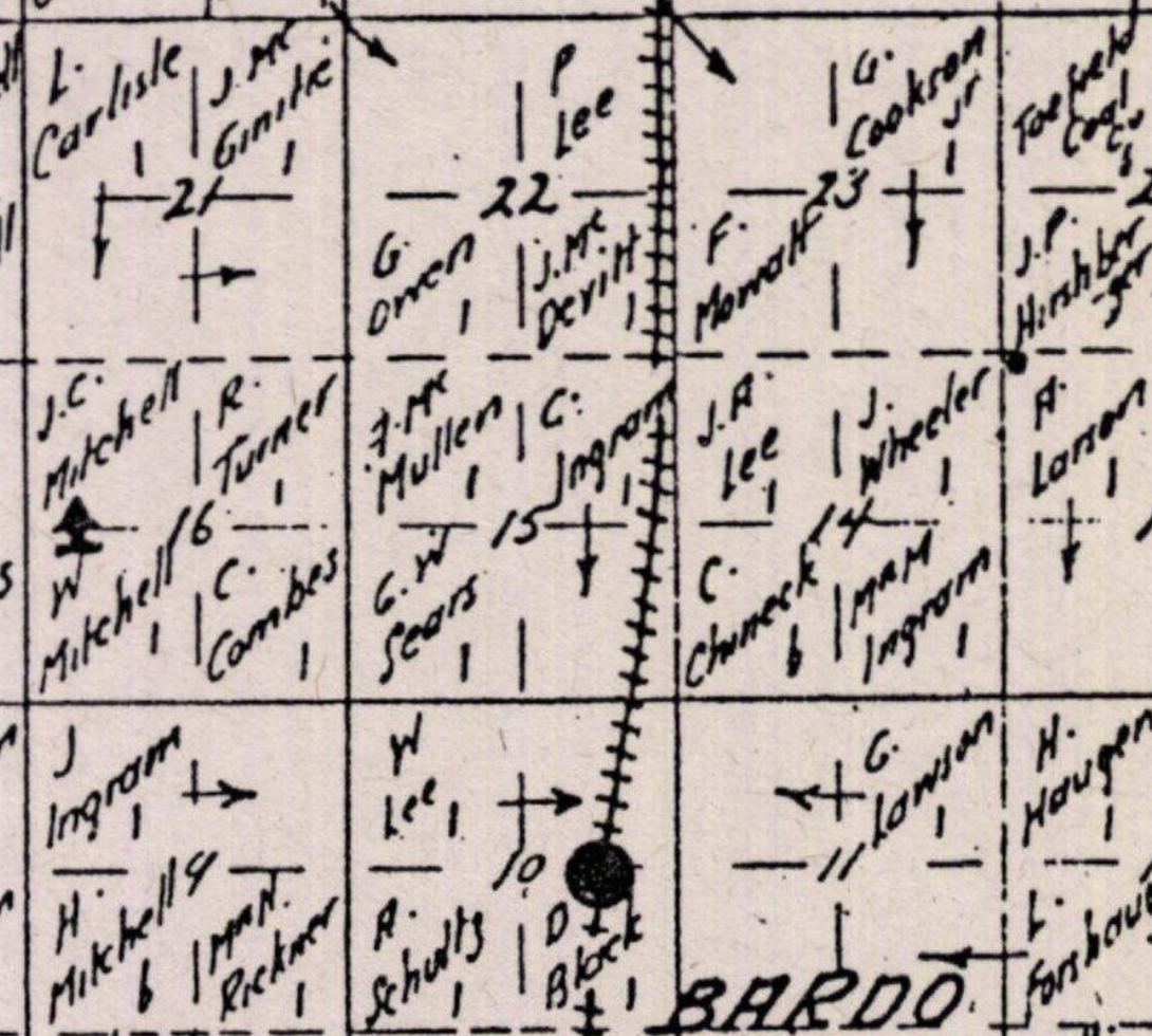
Includes Township and similar maps from Alberta, Canada. Many of them include an ownership map, including many homesteaders, but does not typically show names for CPR lands based on my research so far.
Open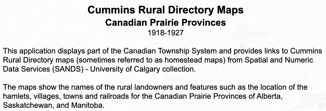
Historical maps that show rural landowners for the prairie provinces of Alberta, Saskatchewan and Manitoba from 1918-1927. The first link below to the University of Calgary app has the most complete set of maps.
Western Canada 1918-1927 - U of C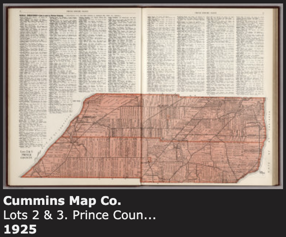
These sources both have maps that include rural landowners for Prince Edward Island counties from about 1925.
University of Prince Edward Island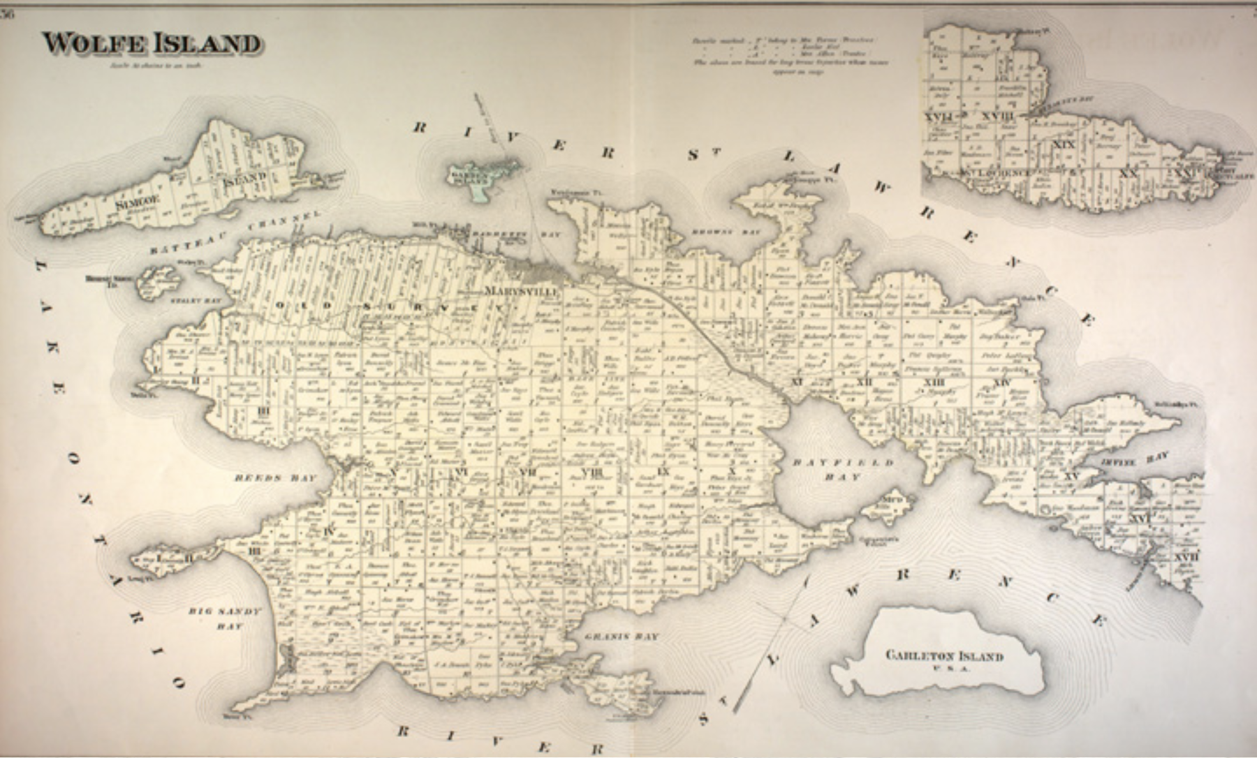
County maps of Ontario from the late 1800s.
NOTE: Zoom in on the page to make it more readable.
OpenThese sites offer maps primarily from the US. I have also included links to some more general sites with search terms set to find sets of land ownership maps.
Includes some plat maps showing land owners. Mostly from the first half of the 1900s
Open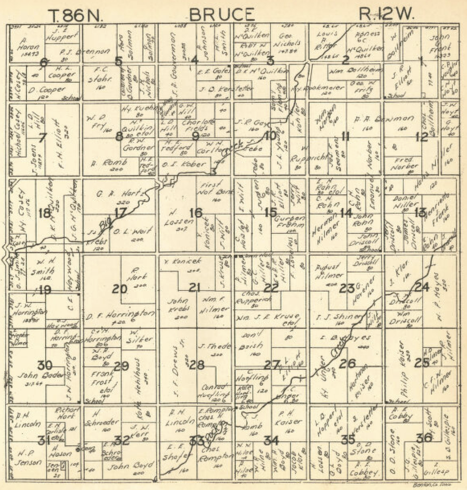
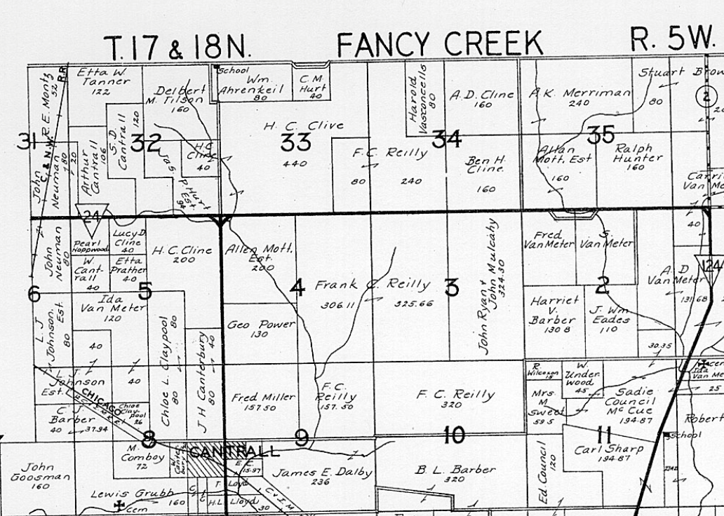
Includes Hixson atlases containing township maps with owners listed for counties in Iowa from 1930.
Open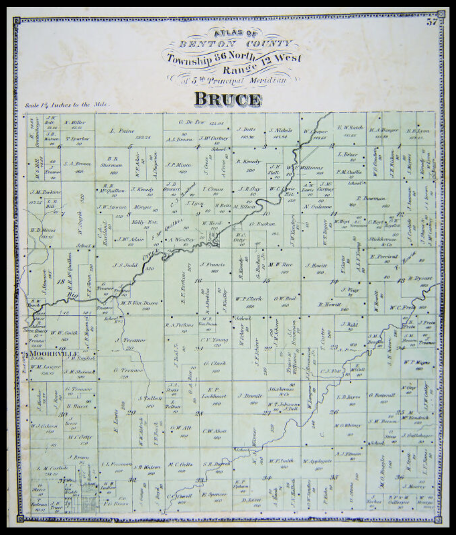
Includes books of township maps with owners listed for counties in Iowa. Late 1800s to early 1900s.
Open
County atlases containing township maps that show rural landowners in Kansas. Early 1900s.
Open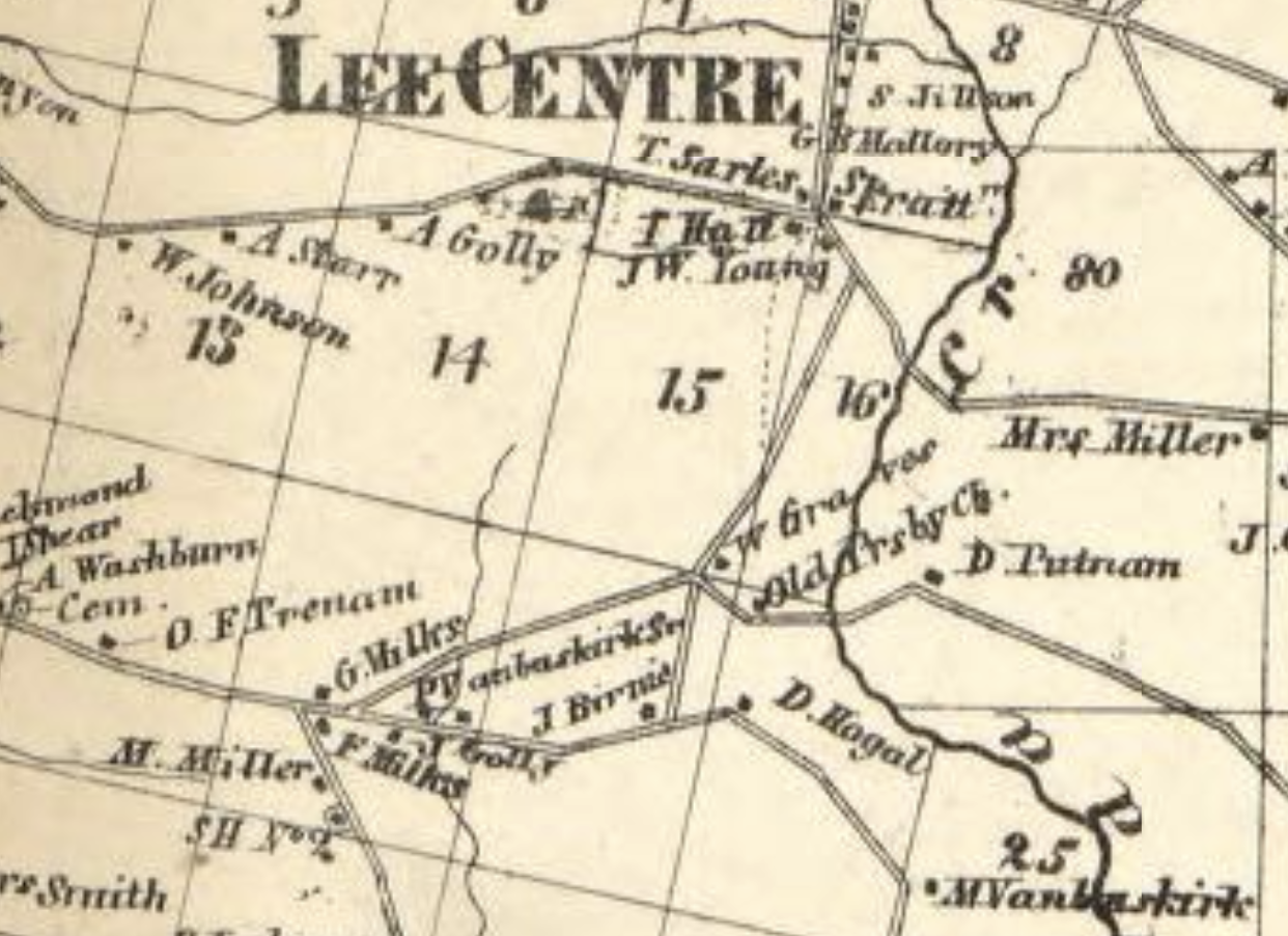
Many ownership maps primarily from the US. Good alternate search terms are owner or householder.
Open