CPR Land Sales Search

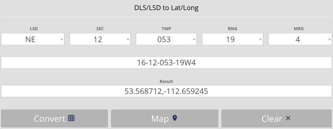
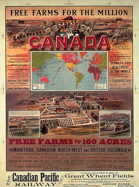
The Canadian Pacific Railway (CPR) was granted land in western Canada to help fund the building the railway.

The University of Calgary has a csv file of public domain records for these land sales. This page provides a searchable version of these records, using indexes I created for the individual locations and names contained in these rceords.

Search Results

Results will appear here after you search.

Data Citation

Search results presented above are from the source below. In some cases the | character has been replaced with a carriage return to improve readability, but othe than that the data is presented as is.

Archives and Special Collections, 2023, "CPR Land Sales Catalogue", https://doi.org/10.5683/SP3/JVTACU, Borealis, V1

Converting the Legal Land Description to GPS Coordinates

If you want to find the gps coordinates or see the location on a map, you can find it using the Legal Description from the results above. For the conversion we will use this free tool.

  1. Click here to open the converter at Bentek Systems.
    Convert
  2. Select the LSD (Part), SEC (Section), TWP (Township), RNG (Range), and MRD (Meridian) in the top row.
  3. Click Convert.
Example: For this search we will use Part (NE), Section (12), Township (53), Range (19) and Meridian (W4). We enter these values, click 'Convert' to see the GPS coordinates, and then click 'Map' to see the location. The coordinates can also be entered into the search box of most online map sites, like Google Maps or Bing Maps.