
There is free information online for those who homesteaded in the United States. On this page I will explain how to find these records and help you locate the land.
There is free information online for those who homesteaded in the United States. On this page I will explain how to find these records and help you locate the land.
You will need to know at least one of the following to get started. Locations are best as they eliminate issues with alternate spellings or transcription errors.
For the examples below we will use the homestead of Joshua Hull, located in Tama, Iowa near Gladbrook. References to the example will be highlighted the same as this paragraph.
If you can find the homestead location on an online map, you can use can Bing Maps to get the GPS coordinates. Once you have found the homestead on the map the GPS coordinates are only a click away.
I know Joshua's homestead was located East of Gladbrook on the quarter containing Conants Park, so I will click near the centre of that section on the map.

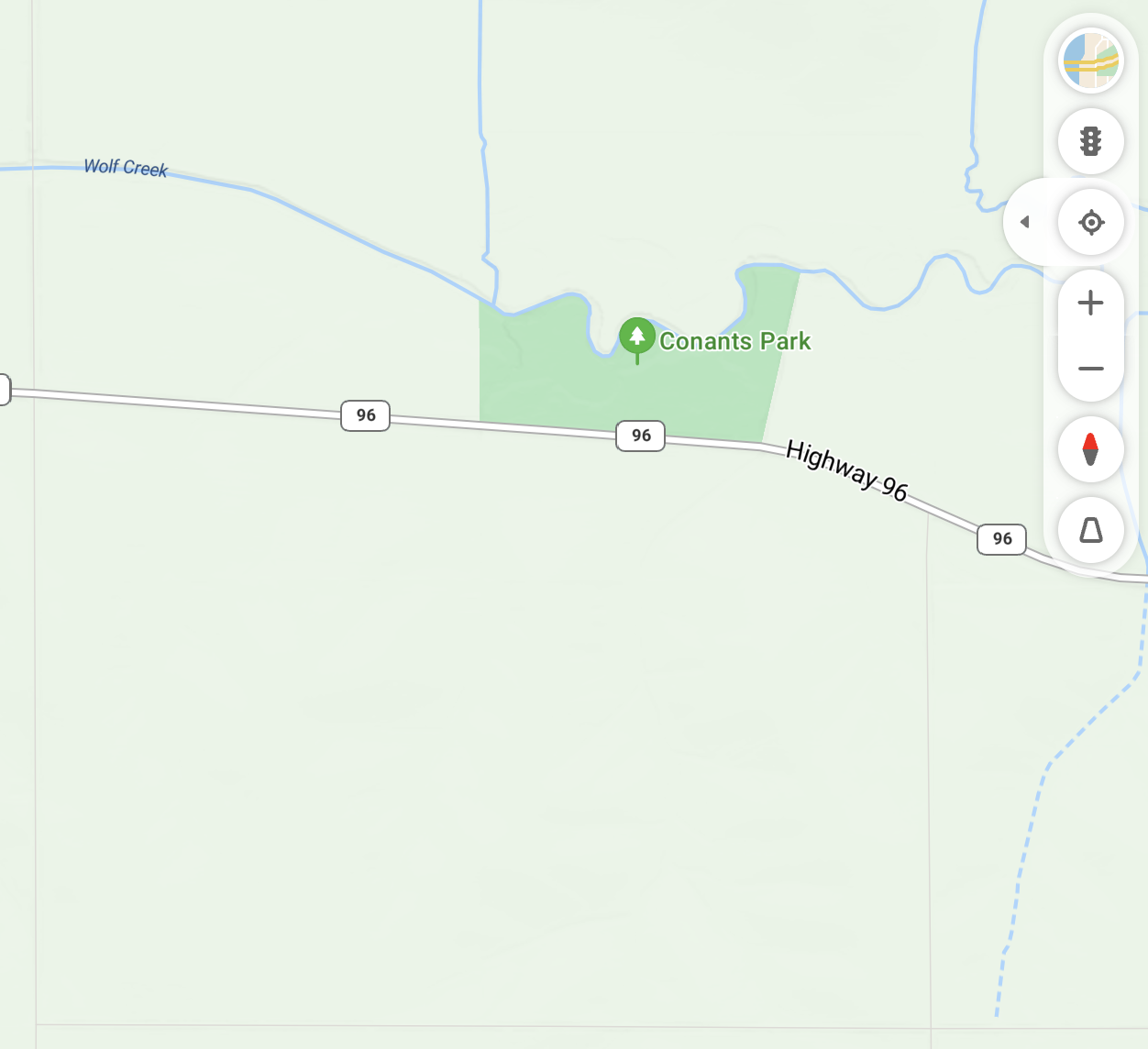
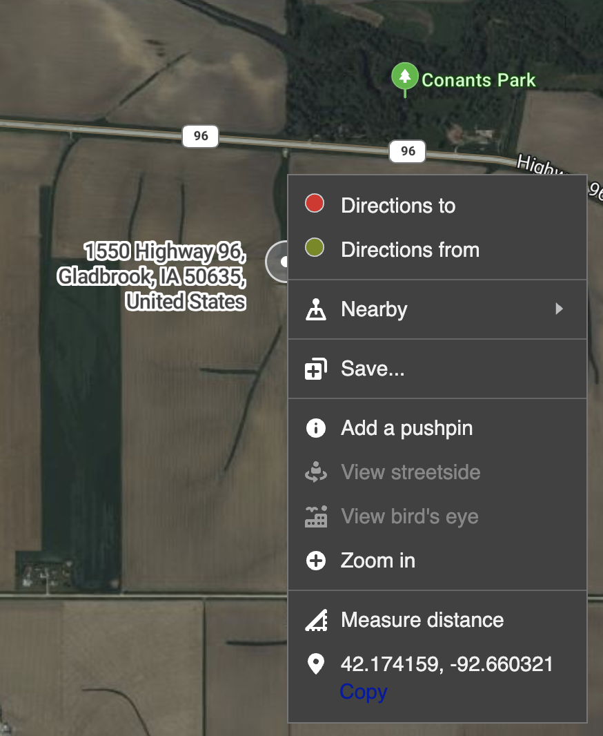
From here we can see Joshua's homestead quarter was located at 42.174159, -92.660321 (Latitude, Longitude).
For the conversion we will use a free tool.
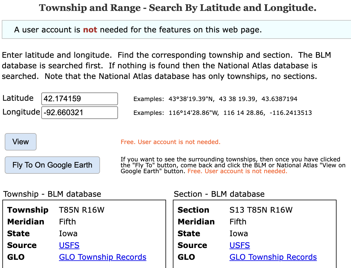
Example: The coordinates of the approximate center of a homestead quarter (42.174159, -92.660321) were entered in the image above and the Convert button produced a result of:
Section: S13 T85N R16W
Meridian: Fifth
State: Iowa
The Land Description includes the following values (in order):
So for the example above we have the following results:
- Section (S): 13
- Township (T): 85N
- Range (R): 16W
- Meridian: Fifth
- State: Iowa
The Bureau of Land Management has a database of Land Patents.
You can search the database here:
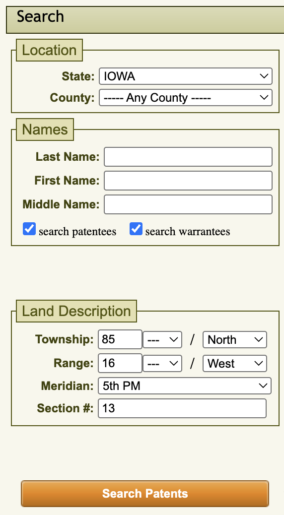
Search Land PatentsExample: We will use the State (Iowa), Township (85 North), Range (16 West), Meridian (5th PM), and Section (13), a homestead section east of Gladbrook, Iowa.
If you searched by location you will likely get a few results, as each section was divided into up to 64 aliquots. Aliquots will be covered in more detail later in this article. If you searched by name you could have many more. If you searched by name and did not find the expected result try using only the surname, variations on the spelling of the name.
Example: There are six results for the search above, three of which list Joshua G. Hull as one of the names.
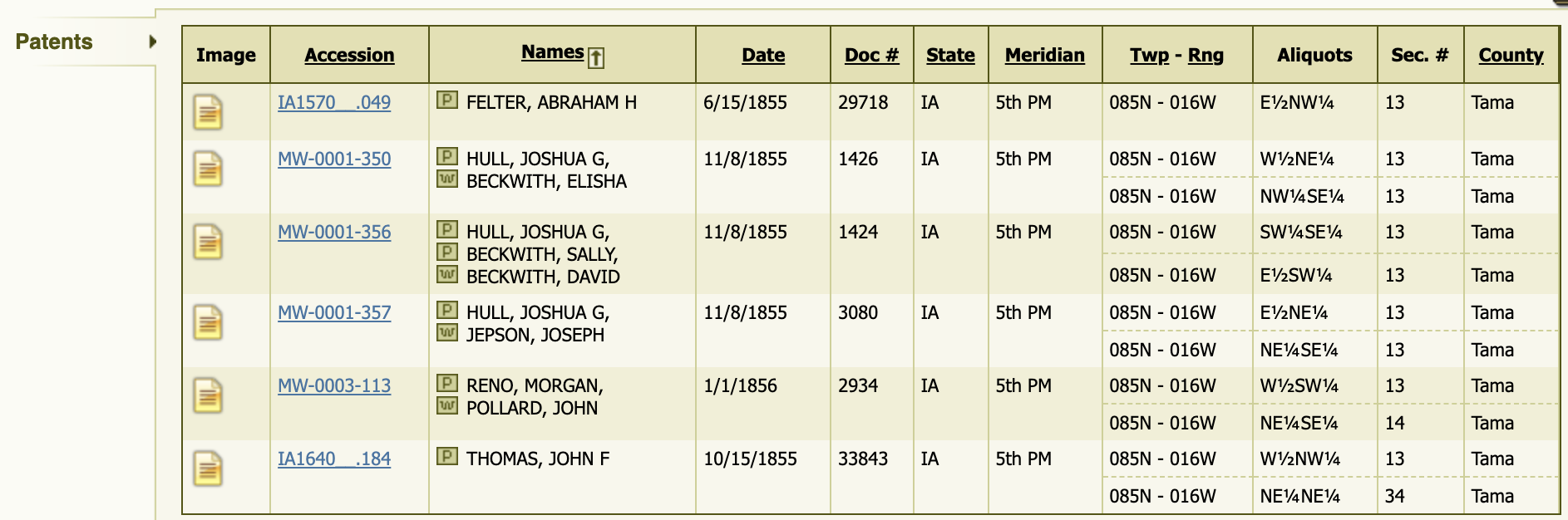
Once you have the correct result click on the Accession Number.
Example: If you select the first result with Joshua G. Hull above you are presented with the following:
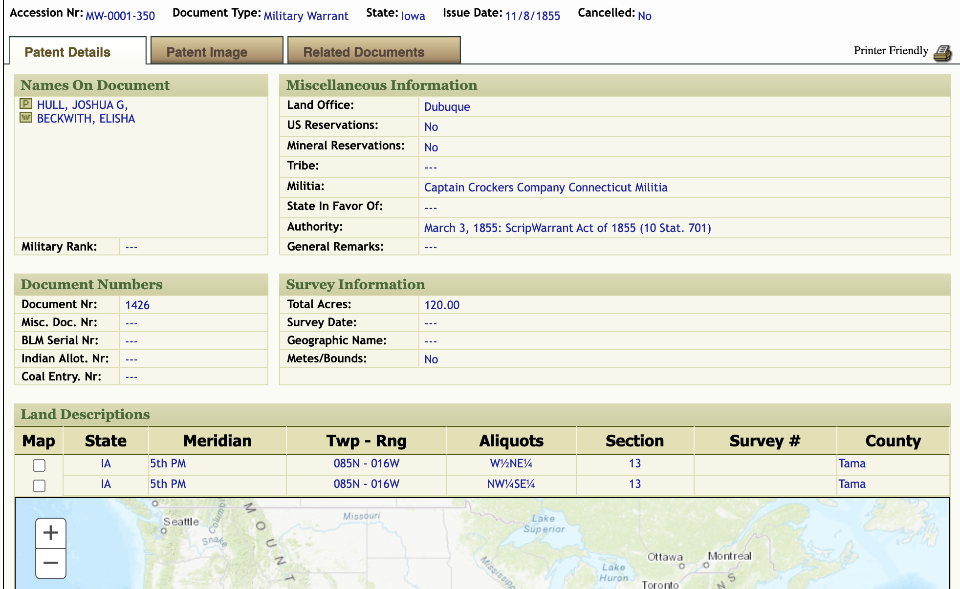
Scroll down and click the checkbox(es) in the Land Description section to see the location(s) on the map.
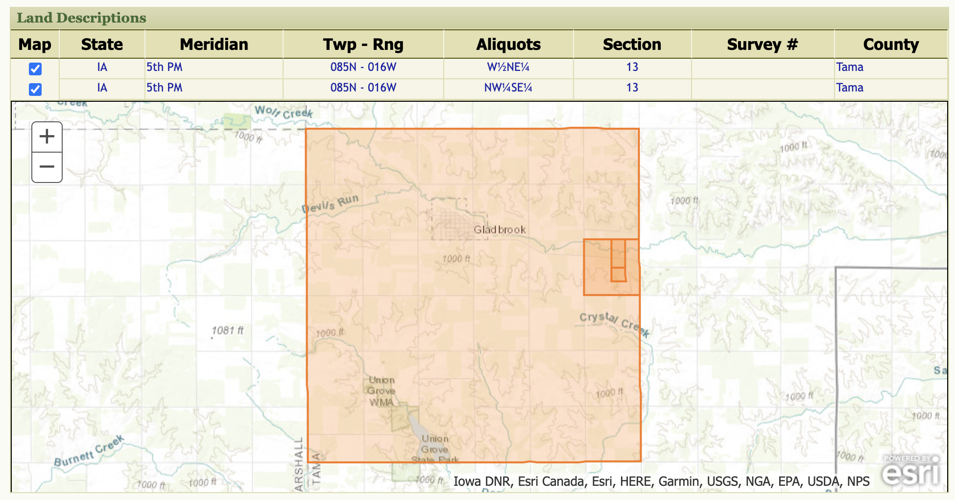
In this example the large square is the Township (85N), with the section (13) as a smaller square, and the two aliquots as a square (NW¼SE¼) and rectangle (W½NE¼).
You can also see an image of the original document by selecting Patent Image.
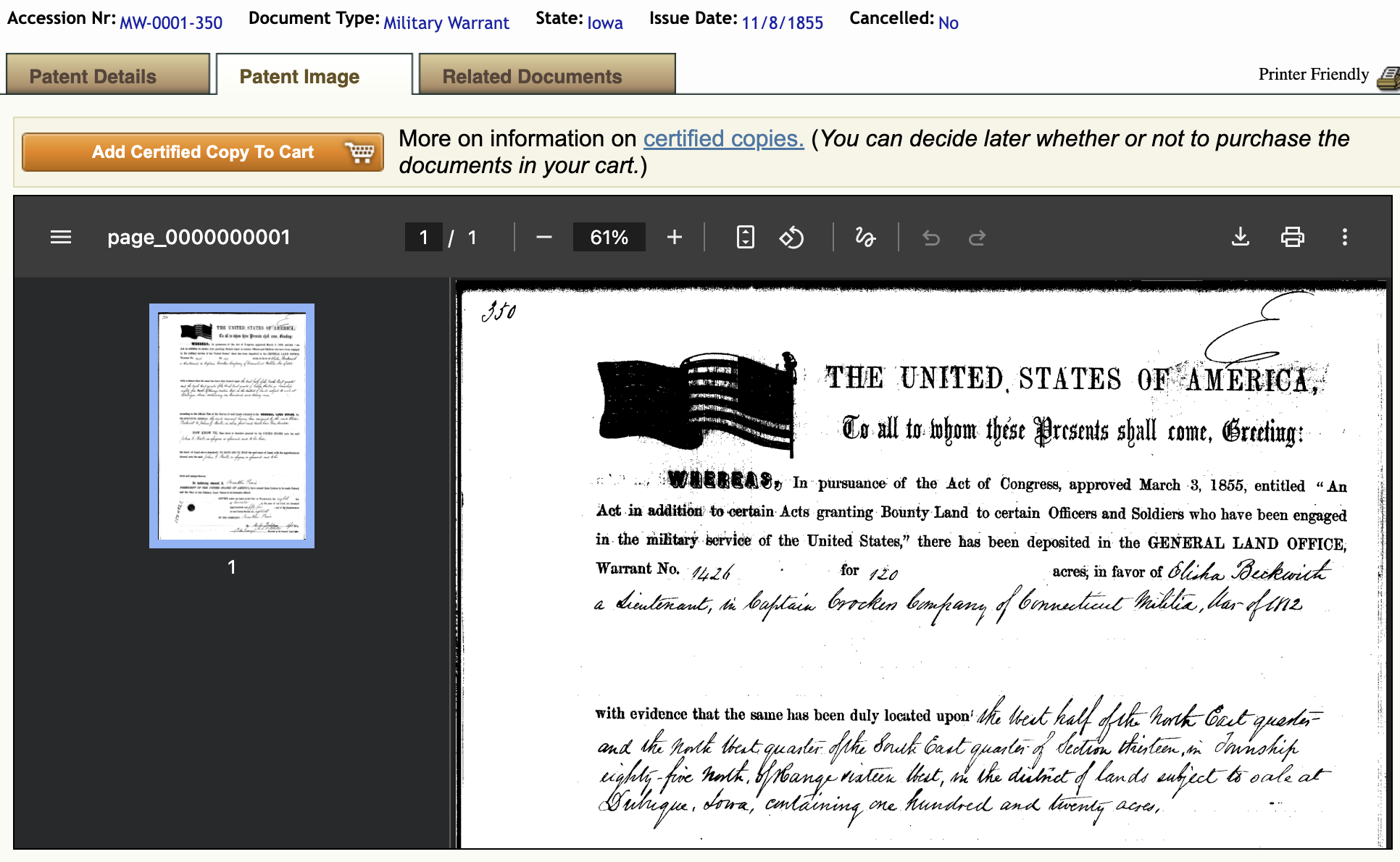
The page that appears will give you some details about the patent. It typically also provides a pdf of the original document. You can download copy of the pdf file.
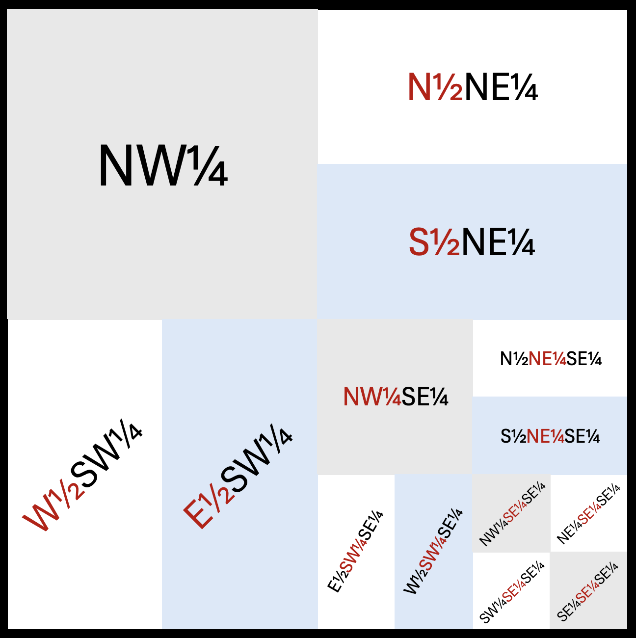
Sections (640 acres) would often be broken up into smaller blocks of land.
If the aliquot includes more than one half or quarter, insert "of the" between each one to make the meaning clear.
Some Examples:
This image shows a hypothetical section divided into assorted aliquots:
If you found the data: Proceed to Step 5.
If you were unable to find the data it is possible they were not homesteaders and obtained the land through other methods.
If you want to find out where this property is located we can find it using the Land Description. For the conversion we will use another free tool.
Note: Two results boxes will appear, one for the Township, and one for the Section. Be sure to use the results under Section. Do not use the results from the Township results box.
Example: For this search we will use the State (Iowa), Principal Meridian (Fifth), Township (085 N), Range (016 W) and Section (12) we found for the Joshua Hull homestead in Step 3. We enter these values, click 'View' to see the GPS coordinates.
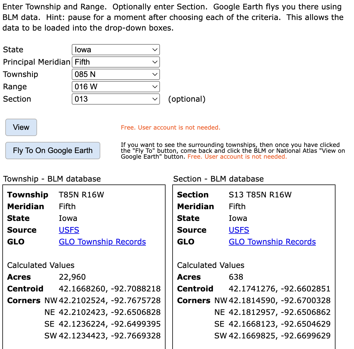
From the results we can see the Centroid of the section is: 42.1741276, -92.6602851
Tbis is the center point of a Section, which is a 1 mile by 1 mile (640 acre) area.These coordinates can be entered into the search box of most online map sites, like Google Maps or Bing Maps.