There is free information online for those who homesteaded in western Canada. On this page I will explain how to find these records and help you locate the land.
There is free information online for those who homesteaded in western Canada. On this page I will explain how to find these records and help you locate the land.
Note: If the homestead is in what is now the provice of Alberta please use our Alberta Homesteads How To as there may be additional documents available.
You will need to know at least one of the following to get started. Locations are best as they eliminate issues with alternate spellings or transcription errors.
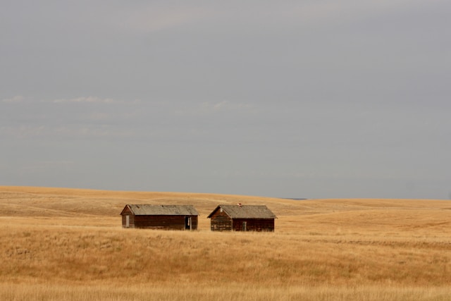
For the examples below we will use the homestead of Jay Van Buskirk, located near Chipman, Alberta. References to the example will be highlighted the same as this paragraph.
If you can find the homestead location on an online map, you can use can Bing Maps to get the GPS coordinates. Once you have found the homestead on the map the GPS coordinates are only a click away. If you are selecting a quarter section of land click near the middle of the quarter for best accuracy.
I know Jay's homestead was located on the quarter SW of the intersection of highway 16 and secondary highway 834, so I will click near the centre of that quarter section on the map.

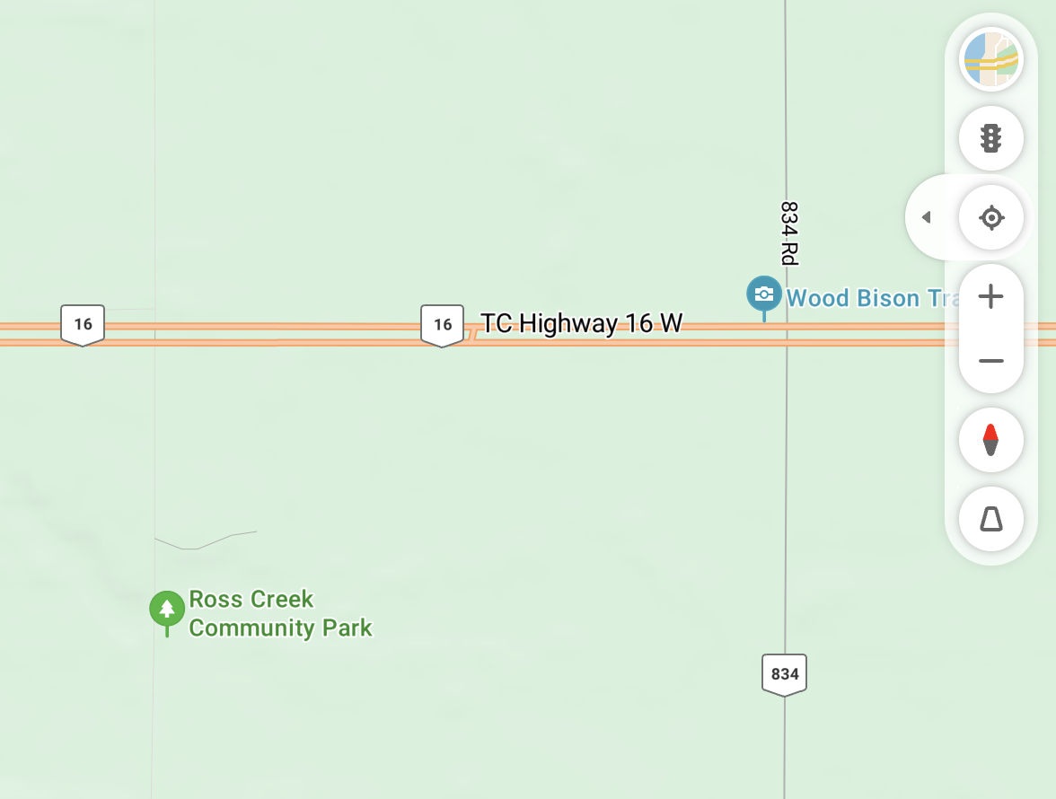
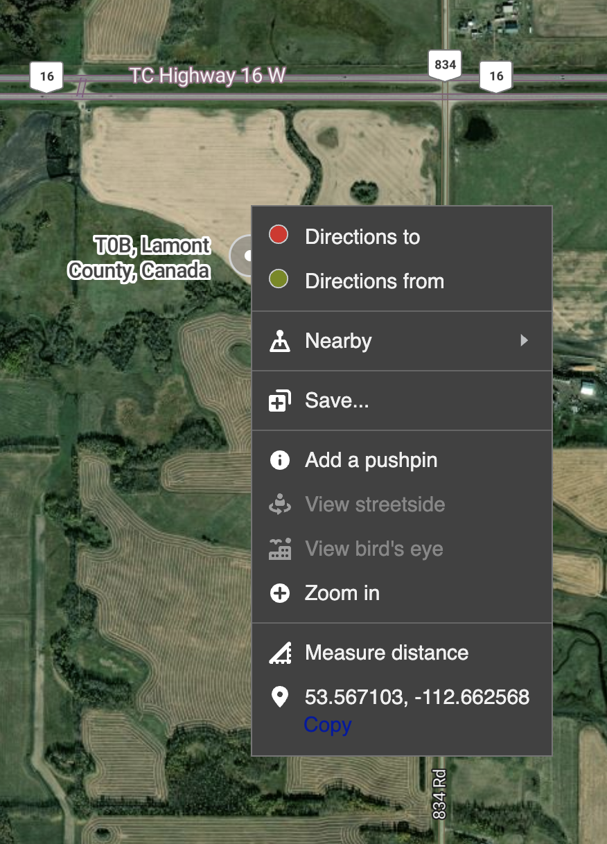
From here we can see Jay's homestead quarter was located at 53.567103, -112.662568 (Latitude, Longitude).
For the conversion we will use a free tool.
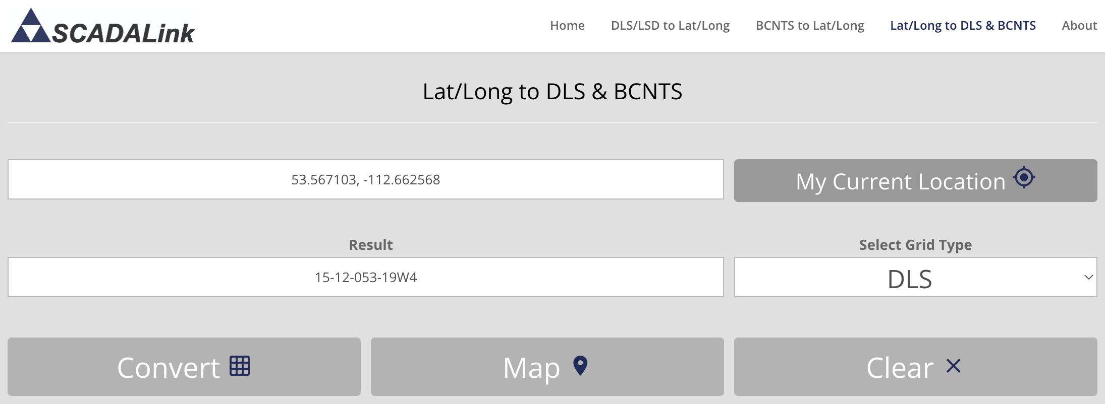
Example: The coordinates of the approximate center of a homestead quarter (53.567103, -112.662568) were entered in the image above and the Convert button produced a result of 15-12-053-19W4.
The Legal Description includes the following values (in order):
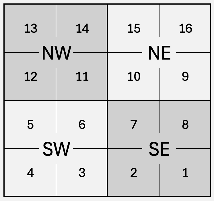
Farmland was typically allocated in Parts (commonly called Quarter Sections or Quarters), so convert the Legal Subdivision (4 Legal Subdivisions per Part) returned above to a Part (Quarter) as follows:
Example: Using the results above we have the Legal Description 15-12-053-19W4 for the quarter centered at 53.567103, -112.662568.This can be recorded as "NE-12-53-19 W4" or stated as "The north-east quarter of section 12, range 53, township 19, west of the 4th meridian."
- Legal Subdivision 15 => Part NE (Using the conversion table/image above.)
- Section 12
- Township 53
- Range 19
- Meridian W4
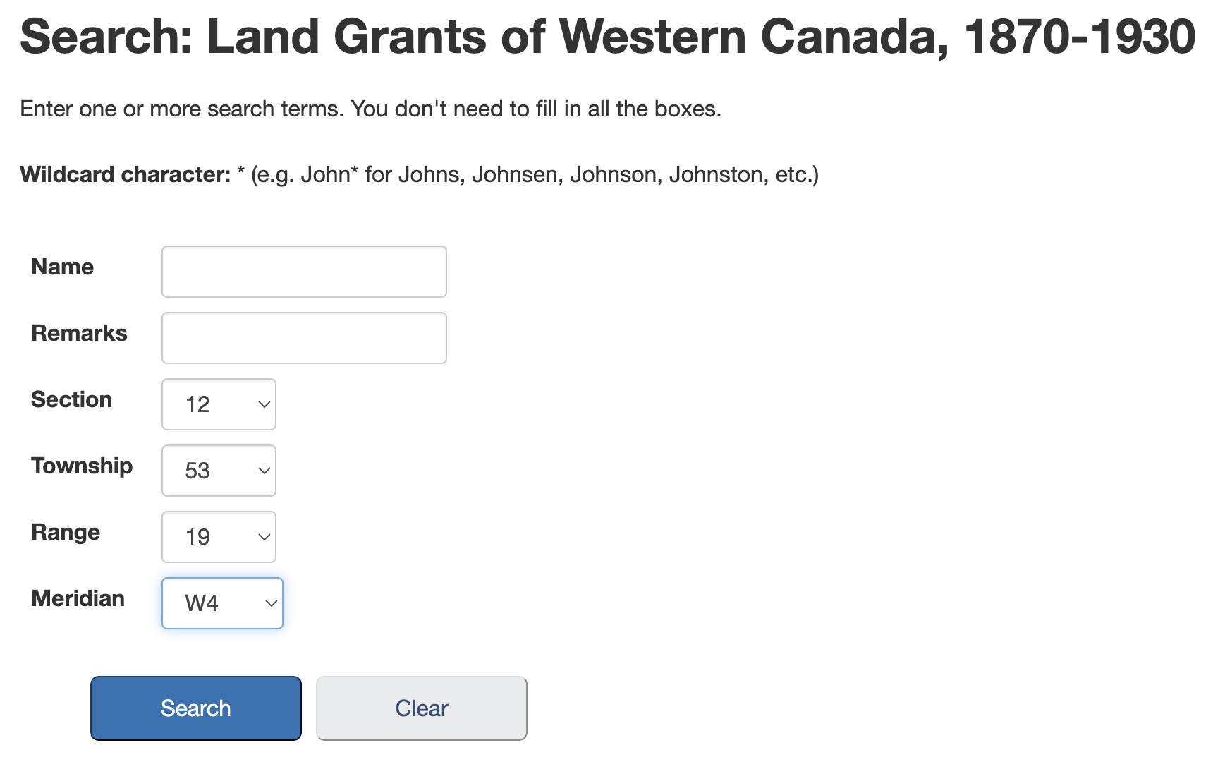
Library and Archives Canada has a database of Western Land Grants (1870-1930).
You can search the database here:
Search Land GrantsExample: We will use the Section (12), Township (53), Range (19) and Meridian (W4), a homestead section east of Edmonton.
If you searched by location you will likely get 4 results, as each section was divided into 4 parts (quarters). If you searched by name you could have many more. If you searched by name and did not find the expected result try using only the surname, variations on the spelling of the name, or given name only.
Example: There are four results for the search above, one for each part (quarter) in the section.
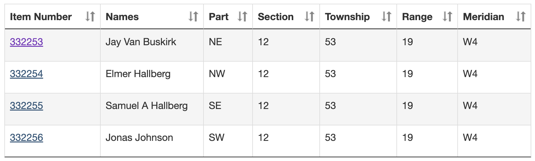
Once you have the correct result click on the Item Number.
Example: If you select the first result above you are presented with the following:
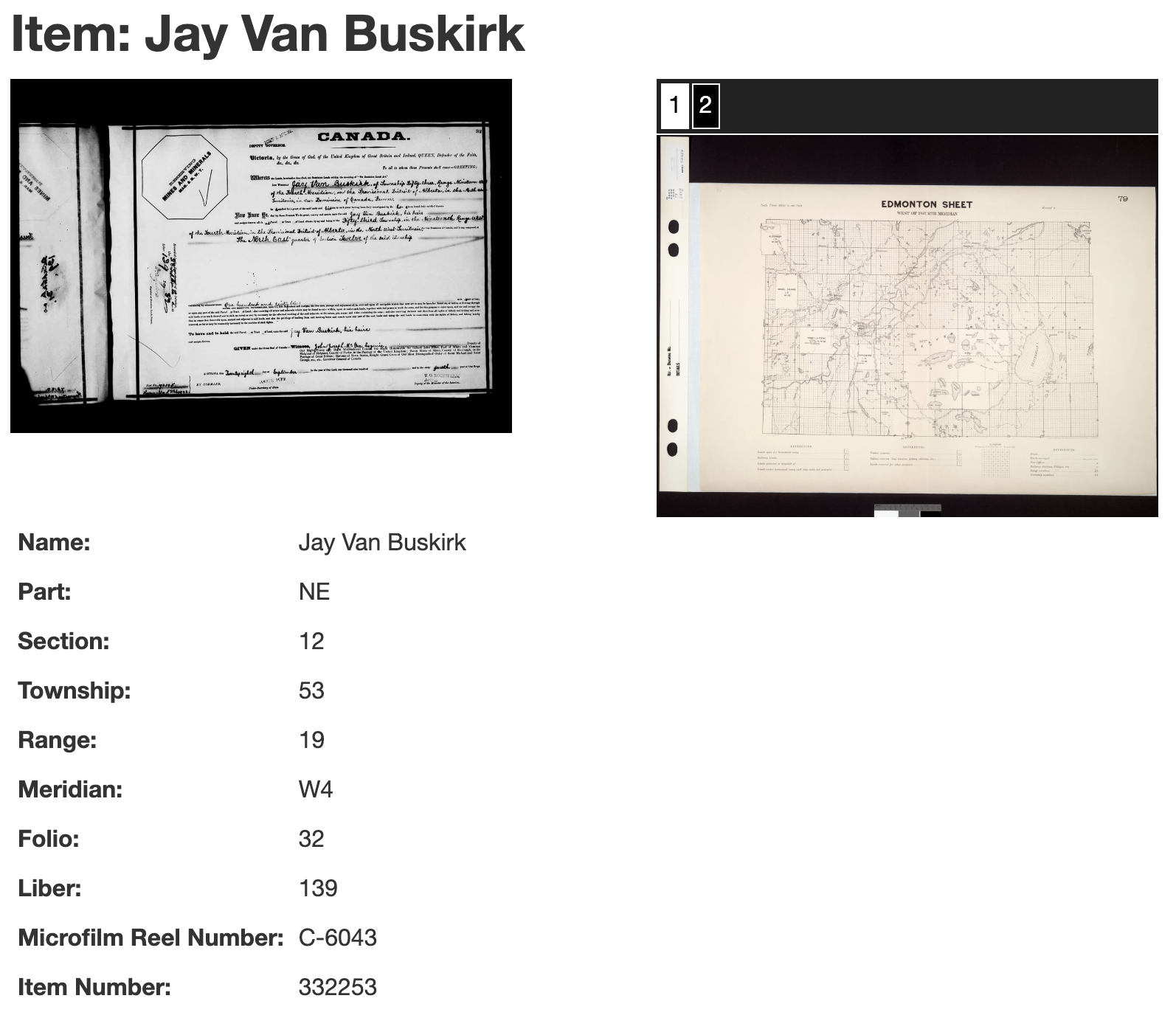
The page that appears will give you the following information:
It may also provide an image of the original document, and possibly maps of the area. If the images have numbers on the top click each number to see the different images. To save the image to your hard drive right click on the image and choose "Save Image As..."
If you found the data: Proceed to Step 5.
If you were unable to find the data it is possible they were not homesteaders.
Many of the land sections were not available as homesteads because they were:
You can try our CPR Land Sales Search to see if they purchased land from the CPR.
Unfortunately I do not know of any free online source for HBC or school land sales.
If you want to find out where this property is located we can find it using the Legal Description. For the conversion we will use another free tool.
Note: This tool does not support E1/EPM meridian in eastern Manitoba.
Example: For this search we will once again use the Part (NE), Section (12), Township (53), Range (19) and Meridian (W4) we found for Jay's homestead in Step 3. We enter these values, click 'Convert' to see the GPS coordinates, and then click 'Map' to see the location.The coordinates can also be entered into the search box of most online map sites, like Google Maps or Bing Maps.